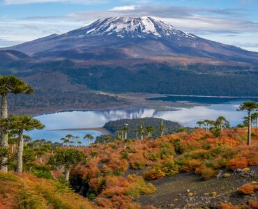
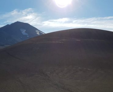
Back country skiing, Conguillio National Park
One of the attractions of Malalcahuello is the closeness of Conguillio National Park and Malalcahuello Reserve. In winter and spring, one can enjoy cross country skiing, splitboard and trekking with snowshoes whilst enjoying amazingly beautiful views of three surrounding volcanoes and ski amongst interesting Monkey Puzzle trees.The three volcanoes volcanoes one can ascend or enjoy views of, are Llaima, Lonquimay and Tolhuaca. Here is an explanation of two possible access routes for accessing Sierra Nevada in Conguillio National Park.
- Route vía Thermal Baths of Malalcahuello. Instead of entering the thermal baths, continue along the road that runs alongside the Claro River. On either side are subdivisions and tourist developments. At the end of the road the route continues as a walking track that goes up towards the northern ridge of Sierra Nevada in Conguillio National Park. At 6.5km past the thermal baths of Malalcahuello in Conguillio National Park there is a flat area suitable for camping, with views of a cascade and Sierra Nevada, an ancient volcano. Continuing up to the ridgeline, one is rewarded by a great view of Volcano Llaima which is situated within Conguillio National Park. The summit is usually accessed going around to the west side from the ridge but should only be attempted by experienced climbers. The summit is some 11.1km from the thermal baths. Local guides are available
- Route 2. Vía Alto Centinella 4WD track, Malalcahuello. The track starts from a dirt road that runs parallel to the Cautín River on the edge of the town of Malalcahuello. Crossing the bridge over the Cautín River behind the town, turn right immediately to the right and continue approximately 300m and take a left-hand turn where there is a street sign “Alto Centinela”. In winter and spring this track can be impassable for the snow or mud, a 4WD is always needed for this 10km long track. Continuing to the end of the road there is a gate marking the private property of Chile Wild (a cabins complex just outside of Malalcahuello) but pedestrians can pass and continue along the track following the yellow markers or making your own track in the snow heading in the direction of Sierra Nevada (2554m at N 5.726.800, E 274.500). Once on the ridgeline you are in Conguillio National Park and can continue to the summit and return vía the same route or take the route back to the thermal baths described in route 1 above, alongside River Claro. The track joins the ridgeline at (WGS84 N 5.730.700 E 273.750). The owners of the private property also offer easy-moderate tours of their Monkey Puzzle Tree conservation park and into Conguillio National Park for guests staying at their cabins in Malalcahuello, they also offer transfers for their guests who are independent and experienced in navigating mountain terrain and backcountry skiing.
It is possible to buy topographic maps of Sierra Nevada & Conguillio National Park from Andes Profundo or some of the local tour operators in the area. There are many options for renting holiday cabins in Malalcahuello or other types of accommodation to serve as a base for your adventures. Contact us for more information on accommodation.